|
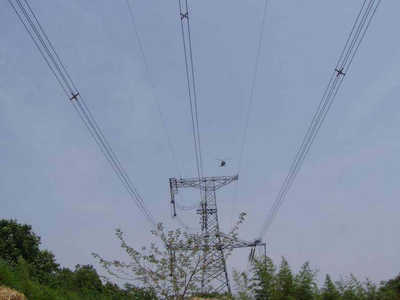
Scene of helicopter powerline corridor survey
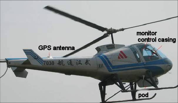
Platform of helicopter powerline corridor survey system
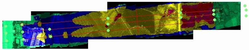
Early-warning image
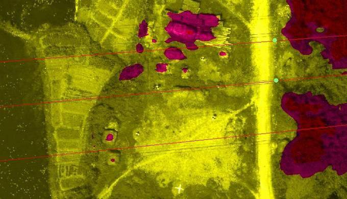
Enlarged view
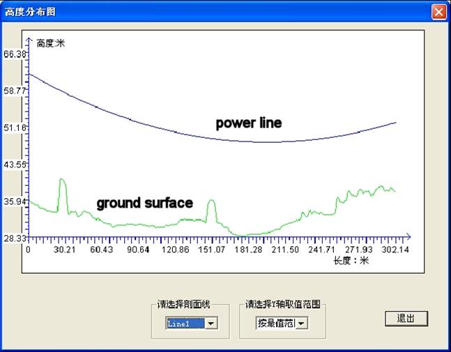
Cross-section view
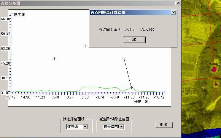
Measure distance between object and powerline in the cross-section view
Scene of helicopter powerline corridor survey
Platform of helicopter powerline corridor survey system
Early-warning image
Enlarged view
Cross-section view
Measure distance between object and powerline in the cross-section view |